

A day hike has one awkward safety problem: it feels simpler than it is. There is no planned overnight, no full camp kit, and often no large time buffer. That makes some decisions too casual. The route is short. The phone has a map. Water should be enough. Darkness feels far away.
I do not treat a day hiking safety checklist as a pile of emergency items. I use it as a control system: route, weather, water, navigation, first aid, light, communication, and the point where the hike stops moving forward.
Most day-hike problems build gradually. The group starts late. Pace is slower than expected. Clouds build faster than the forecast suggested. A junction is missed. Water drops below plan. A checklist exists to catch those small failures before they line up into one larger problem.
Quick Answer
A safe day hike starts with a known route, offline navigation, a weather check, enough water, basic first aid, a headlamp, emergency warmth, a signaling method, and a clear turnaround rule. The most important item is not one piece of gear. It is the decision made before the hike about when to turn back because of time, weather, water, injury, route uncertainty, group condition, or daylight.
What a Day Hiking Safety Checklist Actually Controls
A day hiking checklist is not a survival loadout. It should not turn a normal daypack into a heavy bushcraft pack. Its job is narrower: remove the predictable weak points of a day hike.
Every item or decision should answer a specific question. What happens if the phone fails? What happens if the route takes longer than planned? What happens if someone gets a blister, the weather shifts, water runs low, or the group is still descending near sunset?
| Safety Area | What It Controls | Typical Weak Point | Practical Check |
|---|---|---|---|
| Route plan | Distance, elevation, junctions, exit options | Only checking mileage | Review the route before arriving |
| Navigation | Map access, GPS, compass, route awareness | Depending only on phone signal | Download maps and carry backup if needed |
| Weather | Rain, wind, heat, storms, temperature drop | Checking only the daily forecast | Use hourly weather and trail-area conditions |
| Water | Starting supply and backup treatment | Assuming one bottle is enough | Set a water threshold for turning back |
| First aid | Blisters, cuts, pain, allergy basics, medication | Carrying no kit because the hike is short | Check and customize the kit before leaving |
| Light | Delay, sunset, slow descent | No headlamp on a day hike | Pack light even when planning to finish early |
| Turnaround rules | Decision discipline | Pushing forward too long | Set the rule before the hike starts |
Route Plan: What to Check Before Gear
The first safety item is the route. Gear helps less when the route is vague. Before packing, I want to know the trailhead, distance, elevation gain, main junctions, expected time, bailout options, and sunset.
Mileage alone is not enough. Five miles on a flat shaded forest path and five miles on exposed terrain with a rocky descent are not the same hike. Elevation, footing, exposure, heat, and group pace change the safety margin.
- Trailhead. Confirm the correct starting point, not just the trail name.
- Distance and elevation. Elevation gain changes timing and fatigue.
- Junctions. Identify the places where a wrong turn is most likely.
- Exit options. Know whether the route can be shortened.
- Start and turnaround time. Decide before the route begins.
- Sunset. Daylight margin matters even with a headlamp.
Pack weight should also match the route. A compact safety kit is easier to carry consistently than a heavy set of “just in case” items. For longer hikes, the guide to choosing the right backpack size can help keep safety gear, water, layers, and food organized without overpacking.
Navigation: Phone, GPS, Compass, and the Failure Point
A phone with offline maps is useful. It is not automatically enough. Phones have batteries, screens, water exposure, fall risk, and occasional GPS problems in complex terrain. Signal is not the only failure point.
For simple marked trails, a phone with downloaded maps may be sufficient. For remote routes, confusing junctions, weak signal areas, or solo hikes, I prefer a backup: a handheld GPS, compass, paper map, or a combination.
| Navigation Tool | Best Use | Weak Point | Field Note |
|---|---|---|---|
| Phone with offline map | Simple or popular marked trails | Battery, water, drops, screen visibility | Download the route before reaching the trailhead |
| Handheld GPS | Remote trails and route tracking | Cost, weight, learning curve | Practice before relying on it |
| Compass | Low-tech direction backup | Needs basic skill | Useful only when kept accessible and understood |
| Paper map | Big-picture terrain context | Less useful without map-reading practice | Helps identify drainages, ridges, and exit routes |
Weather and Clothing: Not Just Rain
Weather planning is not only asking whether it will rain. I look at hourly forecast, wind, storm risk, heat exposure, temperature change, elevation, and sunset. The weather near the trailhead may not match the weather on a ridge, pass, canyon, or exposed slope.
Clothing should cover the stopped body, not only the moving body. Hiking produces heat. Waiting after an injury, route error, or storm delay does not. A light layer, rain shell, or wind layer can matter more after stopping than it does during the first hour.
- Hourly forecast. Daily high temperature is not enough.
- Wind and gusts. Wind changes exposure and cooling.
- Thunderstorm risk. Open terrain becomes more serious quickly.
- Elevation change. Higher ground may be colder and more exposed.
- Shade and sun exposure. Heat risk depends on terrain, not only temperature.
- Sunset. Late starts reduce every safety margin.
Water: Amount, Access, and the Point of No Return
Water is not only the amount in the bottle. It is a plan: how much starts in the pack, whether sources exist, whether those sources are seasonal, whether treatment is available, and when low water requires turning back.
A common mistake is counting water to the destination, not to the full return. Water must cover the climb, descent, wrong turns, delays, heat, and slower-than-planned pace.
| Water Check | Why It Matters | Decision Point | Common Error |
|---|---|---|---|
| Starting volume | Prevents early shortage | Set before leaving the car | Starting with “probably enough” |
| Water sources | Determines whether a filter is useful | Confirm before the hike | Assuming a stream will be flowing |
| Filter or treatment | Adds backup where water exists | Pack only with a water plan | Using a filter as an excuse to carry too little |
| Heat and exposure | Raises water demand | Adjust before start | Ignoring sun and elevation |
| Turnaround threshold | Prevents running low too far out | Turn back before water becomes urgent | Waiting until the bottle is nearly empty |
First Aid: Compact, but Not Symbolic
A day-hike first aid kit should be compact, but it should still be real. A sealed pouch that has never been opened is not preparation. It is inventory.
Most day-hike first aid needs are ordinary: blisters, small cuts, tape, gauze, pain relief, allergy medication, personal medication, and gloves. The point is not to carry a clinic. The point is to stop small problems from controlling the route.
- Blister care. Hot spots should be treated before they open.
- Tape and gauze. Useful for small injuries and improvised support.
- Antiseptic wipes. Basic cleaning for cuts and scrapes.
- Personal medication. Add what a generic kit will not include.
- Allergy medication. Important when relevant to the hiker.
- Gloves. Small, light, and useful when helping someone else.
The kit should be checked before the hike. A first aid pouch opened for the first time in rain, wind, or pain is harder to use well.
Light, Signaling, and Emergency Warmth
A headlamp on a day hike is not a plan to hike in the dark. It is protection against delay. A late start, slow descent, route error, blister, or weather pause can turn the final part of a trail into a low-light problem.
A phone flashlight is a weak replacement. It drains phone battery, occupies one hand, and is awkward while moving. A headlamp is hands-free and better for walking, reading a map, checking gear, or helping with first aid.
Signaling and warmth are similar. They look unnecessary until the delay is real. A whistle is lighter and more sustainable than shouting. An emergency bivvy is not a planned sleep system. It is a heat-retention tool for a forced stop.
| Item | Role | Beginner Mistake | Carry Position |
|---|---|---|---|
| Headlamp | Light for delay or dark return | Leaving it home on a short hike | Accessible, not buried |
| Whistle | Emergency signal | Relying only on voice | Strap, pocket, or shoulder area |
| Emergency bivvy | Heat retention during forced stop | Treating it as comfort gear | Inside pack, protected and findable |
| Extra layer | Wind, cold, and waiting buffer | Dressing only for active movement | Near top of pack |
For a deeper look at lighting choices, see the guide to headlamps and camp lighting.
Communication and No-Signal Planning
Before a day hike, someone outside the group should know the route, trailhead, expected return time, and what to do if the group is late. This is not dramatic. It is a basic protocol.
The phone should be charged. Offline maps should be downloaded before the trailhead. In weak-signal areas, airplane mode can preserve battery when the phone would otherwise keep searching for service. A power bank can help, but it does not replace telling someone the plan.
A satellite communicator is not necessary for every day hike. It is more relevant for solo hiking, remote terrain, no-service areas, long approaches, and routes where phone-based emergency communication is unreliable.
- Phone. Convenient, but vulnerable to battery, signal, and damage.
- Handheld GPS. Navigation support, not a communication device.
- Compass. Battery-free direction backup.
- Satellite communicator. Messaging and SOS support where cell signal is unreliable.
Turnaround Rules: The Checklist Item People Usually Ignore
A turnaround rule should be set before the hike starts. Not on the ridge. Not near the viewpoint. Not when the destination looks close and the group wants “a little farther.”
A good rule is specific. Turn back at a fixed time. Turn back if thunder appears. Turn back when water drops below the planned threshold. Turn back if route uncertainty cannot be resolved. Turn back early when a minor injury starts changing pace.
| Trigger | Turnaround Rule | Why It Matters | Bad Habit |
|---|---|---|---|
| Time | Turn back at a fixed time | Protects daylight and descent margin | Continuing because the destination is close |
| Weather | Turn back at thunder, fast cloud build, high wind, heavy rain, or heat stress | Weather can reduce route options quickly | Waiting for conditions to become obvious |
| Water | Turn back before water becomes a problem | Prevents shortage far from the trailhead | Drinking down to the last reserve |
| Navigation | Stop, confirm, and turn back if uncertainty continues | Wrong turns multiply time and water use | Walking while guessing |
| Injury | Turn back while the issue is still small | Small problems can become evacuation problems | Ignoring hot spots, limping, or pain |
| Group condition | Turn back if pace drops sharply or someone is clearly fading | The group moves at the pace of its weakest member | Letting pride set the pace |
Product Examples Worth Considering
The items below fit specific safety roles. They are not a single required kit for every route. A short local trail and a remote exposed day hike do not need the same loadout.
Garmin GPSMAP 65s Handheld GPS
The Garmin GPSMAP 65s covers the handheld GPS role. It is not a satellite messenger and not a substitute for planning. It is a dedicated navigation tool for remote day hikes, route tracking, and situations where phone-only navigation is too thin.
For a simple marked trail, it may be more than needed. For longer routes, confusing terrain, or no-service areas, a separate GPS with physical controls can make sense.

| Brand | Garmin |
|---|---|
| Model | GPSMAP 65s Handheld GPS |
| Best For | Handheld GPS navigation backup, remote day hikes, route tracking, and map-based navigation |
| Key Strength | Outdoor-focused GPS navigation with button control and multi-band / multi-GNSS support |
| Main Limitation | More expensive and heavier than simple phone/offline-map navigation |
Suunto A-10 Compass
The Suunto A-10 Compass is a simple low-tech backup. It does not replace a phone or GPS, but it gives a battery-free way to check direction when used with basic navigation skill.
A compass is only useful if the hiker understands the basics. It should be treated as a skill item, not a charm in the pack.

| Brand | Suunto |
|---|---|
| Model | A-10 Compass |
| Best For | Basic map-and-compass backup, simple route orientation, and low-tech navigation |
| Key Strength | Lightweight, battery-free direction tool |
| Main Limitation | Requires basic compass skill to be useful |
Black Diamond Spot 400 Headlamp
The Black Diamond Spot 400 Headlamp is a day-hiking safety item, not only a camping light. Its role is delay management: late return, wrong turn, slow descent, or a stop that lasts longer than expected.
The headlamp should be accessible and checked before the hike. A light buried at the bottom of the pack is less useful when daylight is already fading.

| Brand | Black Diamond |
|---|---|
| Model | Spot 400 Headlamp |
| Best For | Late returns, dark trail sections, emergency delay, and hands-free light |
| Key Strength | Keeps both hands free while moving, reading a map, or checking gear |
| Main Limitation | Needs battery management and should be tested before the hike |
Sawyer Squeeze Water Filter
The Sawyer Squeeze Water Filter fits routes with real water sources. It is a backup and flexibility tool, not a reason to start with too little water.
On dry trails, a filter is dead weight. On routes with known streams, lakes, or reliable water points, it can add margin if the hike runs longer than planned.

| Brand | Sawyer |
|---|---|
| Model | Squeeze Water Filter |
| Best For | Water treatment backup, routes with known water sources, and longer day hikes |
| Key Strength | Compact filter option for treating backcountry water |
| Main Limitation | Does not help on dry routes and still requires clean handling |
Adventure Medical Kits Ultralight/Watertight .7
The Adventure Medical Kits Ultralight/Watertight .7 is a compact first aid base for day hiking. It fits the ordinary trail problems: blisters, small cuts, tape needs, basic medications, and minor injuries.
A premade kit should still be checked and customized. Add personal medication, allergy items, or extra blister care if needed.

| Brand | Adventure Medical Kits |
|---|---|
| Model | Ultralight/Watertight .7 |
| Best For | Day hiking first aid, blisters, small cuts, medications, and compact emergency care |
| Key Strength | Compact and weather-resistant first aid organization |
| Main Limitation | Should be checked and customized before use |
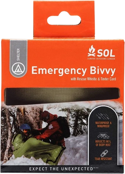
SOL Emergency Bivvy
The SOL Emergency Bivvy is emergency warmth for a forced stop. It is not a planned shelter and not a comfort item. Its value appears when a hiker is injured, delayed, cold, or waiting in poor weather.
For exposed routes, cold seasons, solo hikes, and remote terrain, compact emergency warmth can be more important than it looks at the trailhead.
| Brand | SOL |
|---|---|
| Model | Emergency Bivvy |
| Best For | Emergency warmth, forced stop, weather delay, and cold exposure |
| Key Strength | Compact warmth backup for unexpected delays |
| Main Limitation | Emergency tool, not a comfort shelter or planned sleep system |
Fox 40 Classic Whistle
The Fox 40 Classic Whistle is a simple signal tool. It is light, battery-free, and more sustainable than shouting when repeated signaling is needed.
It should be accessible. A whistle buried deep in a pack is less useful than one attached to a shoulder strap or stored in a quick-access pocket.

| Brand | Fox 40 |
|---|---|
| Model | Classic Whistle |
| Best For | Emergency signaling, group separation, and attracting attention |
| Key Strength | Loud, simple, battery-free signal tool |
| Main Limitation | Only useful if kept accessible and used with a clear signal pattern |
Garmin inReach Mini 2
The Garmin inReach Mini 2 fills the remote communication role. In this checklist it is not the main navigation device. Its value is satellite messaging and SOS support where phone signal is unreliable or absent.
It is not necessary for every local trail. It makes more sense for remote routes, solo hiking, no-service terrain, long approaches, or places where delayed communication would make a small problem more serious.

| Brand | Garmin |
|---|---|
| Model | inReach Mini 2 |
| Best For | Remote communication, satellite messaging, and SOS-capable hiking safety |
| Key Strength | Communication option when phone signal is unavailable |
| Main Limitation | Expensive and requires subscription or service planning |
The Actual Day Hiking Safety Checklist
This checklist is built around decision points rather than gear collecting. Adjust it by route length, weather, remoteness, group size, and season.
Before You Leave
- Route checked for distance and elevation.
- Trailhead confirmed.
- Offline map downloaded.
- GPS, compass, or navigation backup packed if the route needs it.
- Hourly weather checked.
- Sunset time checked.
- Water amount planned.
- Water filter packed if the route has real water sources.
- First aid kit checked and personalized.
- Headlamp packed and battery checked.
- Emergency warmth packed.
- Phone charged.
- Power bank packed for longer or remote routes.
- Route and expected return time shared with someone.
- Turnaround time decided before starting.
At the Trailhead
- Confirm the route again.
- Check actual weather and wind.
- Note start time.
- Check water before leaving the car.
- Put headlamp, whistle, and first aid where they are reachable.
- Make layers accessible.
- Check group condition.
- Reconfirm turnaround time.
On the Trail
- Check time regularly.
- Check water before it becomes low.
- Watch cloud, wind, and temperature changes.
- Confirm route at junctions.
- Treat hot spots before blisters open.
- Watch group pace.
- Turn back early if the margin shrinks.
- Do not use the headlamp as an excuse to push late.
- Stop and reassess if navigation becomes uncertain.
Common Day Hiking Safety Mistakes
Most day hiking mistakes come from treating a short route as if it cannot become complicated. The gear can be lighter than an overnight kit, but the decision process still matters.
- Starting too late. A late start removes daylight margin and makes every delay more expensive.
- Depending only on phone signal. Offline maps help, but battery, water, drops, and screen visibility still matter.
- Not packing a headlamp. A headlamp is for delay management, not only overnight hiking.
- Carrying water without a water plan. Water planning includes amount, sources, treatment, and a turnaround threshold.
- Ignoring blisters early. Hot spots are easier to fix than open blisters.
- Pushing past turnaround time. A rule that moves every time the destination feels close is not a rule.
- Assuming short hikes cannot become serious. Short hikes still have weather, injury, wrong turns, and delays.
- Carrying gear without knowing how to use it. Compass, GPS, filter, first aid, and satellite devices should be tested before the problem starts.
Limitations and Trade-Offs
No checklist is perfect. A useful day hiking kit must balance risk, weight, route type, and actual skill. Carrying more is not always better. Carrying too little is worse when conditions change.
- More gear vs more weight. A checklist that becomes too heavy will be ignored.
- Phone navigation vs dedicated GPS. Phone navigation is convenient; dedicated GPS is stronger for some remote routes.
- Water weight vs water risk. Water is heavy, but running out is worse.
- Emergency bivvy vs real shelter. A bivvy is a delay tool, not planned shelter.
- Satellite communicator vs cost. Satellite communication is expensive and not required for every trail.
- Checklist vs judgment. A checklist supports decisions. It does not replace them.
Frequently Asked Questions
What should I always carry on a day hike?
Carry navigation, water, weather-appropriate layers, first aid, a headlamp, emergency warmth, a whistle or signaling tool, a charged phone, and a route plan. Adjust the kit for distance, weather, terrain, and remoteness.
Do I need a headlamp for a day hike?
Yes. A headlamp is for delays, not planned night hiking. If the route takes longer than expected, hands-free light is safer than using a phone flashlight.
Is a phone enough for hiking navigation?
For simple marked trails, a phone with offline maps may be enough. For remote trails, confusing terrain, or weak-signal areas, a GPS or compass backup is safer.
How much water should I carry for a day hike?
It depends on heat, distance, elevation, pace, and water availability. Carry more than the bare minimum and set a water-based turnaround rule. A filter helps only if there are real water sources.
When should I turn around on a hike?
Turn around at the fixed turnaround time, when weather shifts, water drops below the threshold, navigation becomes uncertain, someone is injured, group pace collapses, or daylight margin becomes too small.
Do I need a satellite communicator for day hiking?
Not for every hike. It is most useful for remote routes, solo hiking, no-signal terrain, and places where phone-based emergency communication is unreliable.
Conclusion
Day hiking safety should be light, but not casual. This is not an overnight kit and not a bushcraft loadout. It is a compact system for navigation, water, weather, first aid, light, warmth, signaling, communication, and decision-making.
The useful items are the ones that solve predictable problems: the route becomes unclear, water drops faster than planned, daylight shrinks, a blister changes pace, weather shifts, or the phone has no signal. Gear matters only when it supports a clear plan.
The main item on my checklist is the turnaround rule. When that rule is set before the hike and followed on the trail, most other safety decisions become cleaner. A safe day hike is not a route where nothing can go wrong. It is a route with enough margin to keep small problems small.